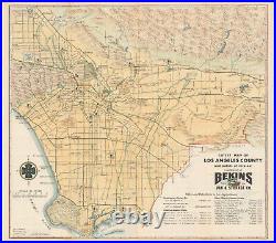

A beautiful, hand-colored 1950 map of Los Angeles. This attractive 1950 map depicts Los Angeles County, stretching north-south from the San Fernando Valley and Pasadena to Long Beach and Palos Verdes, and east-west from Pomona to Santa Monica. It depicts the city in the midst of its post-WWII boom, a time in which the city and its famous industries grew to reach new heights.

