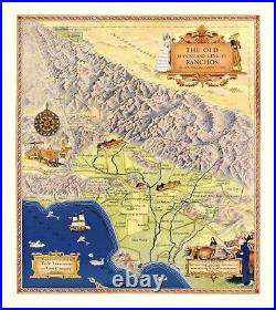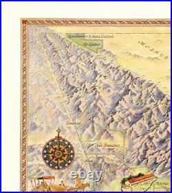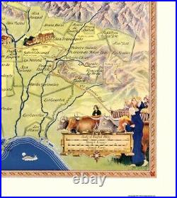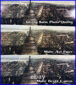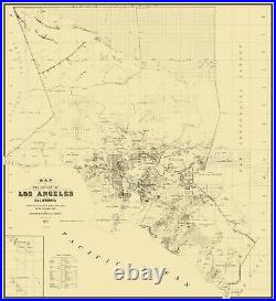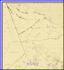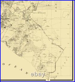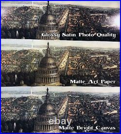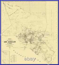
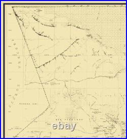
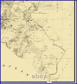

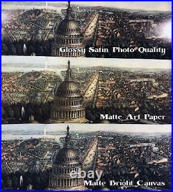

Los Angeles County California – Wildy 1877. Old County Map – Los Angeles California Landowner – 1877 – This is an exquisite full-color Reproduction printed on high-quality gloss paper, art paper or canvas. Print Size: 23.00 x 25.19 inches Sites and Townships Specific To This Map Are: Hundreds of Named Landowners; Inserts of: Wilmington, Newport, Capistrano, Table of Distances, Bald Creek, Puente Hills, Mt. Parkinson, San Fernando Mountains, Little Tulunga Canyon, Cucamongo Peak, Verdugo Canon, Hill of San Felipe, Jose Hills, Mt. Baker, Road to Fort Tejon, Moores Road, Stage Road to San Bernardino, Los Angeles & Indepence Railroad, Monte Vista Road, Sycamore Swamp, Elizabeth Lake, Santa Clara River, Los Angeles River, San Gabriel River, Santa Ana River, Rattlesnake Island, Hydrualic Mining District, Coal Mining Claim, Sepulveda Salt Works, Mission Vieja or La Paz, Lancaster Station, Alpine Station, Ravana Station, Feliz Ranch Ranchos of: San Pedro, San Juan Cajon, Santa Gertrudes, La Habra, San Francisco, El Elcino, Potrero Grande, La Merced, Las Cienegas, San Antonio, De Santa Ana; Farm Homestead Association. The following towns are featured: Soledad City, City of San Fernando, Burbank, Roberts, La Brea, El Monte, Lexington, Los SKU: CALO0002 Original Maps are often difficult to find and usually have fold lines, identifying stamps or markings, tears, ragged edges, and assorted other natural signs of age that detract from their beauty. All of our maps have been professionally restored to depict their original beauty, while keeping all historical data intact. These maps are fabulous pieces of history full of information useful to Historians, Genealogists, Cartographers, Relic Hunters, & Others. They make fascinating conversation pieces and splendid works of art for the home or office. This extremely difficult to obtain map, referred to as a “Land Ownership” map is a rare commodity. It is entitled a “Land Ownership” map because it indicates the original land owner plot number and many times their names. Glossy Satin Photo Quality. This is a very high quality, photo-grade, 7 mil thick paper. It is considered a “matte” finish, however it does have a slight sheen to it. It is a very nice paper and produces extremely attractive maps. This archival fine-art media has the look and feel of old-world handmade paper and is great for producing sharp, accurate reproductions. The Giclee process, combined with a 12 mil thick paper, creates magnificent historical maps guaranteed not to fade, yellow, or crack for more than 100 years. The quality of these matte-finish maps is recognized by museums and galleries around the world. Ideal for framing, the poly/cotton blend archival-grade canvas will satisfy even the most discriminating taste. This canvas has a medium gloss finish, and after printing via the Giclee process, your historical maps are guaranteed not to fade, yellow, or crack for more than 100 years. The result is truly magnificent and ideal for those seeking the look and feel of an actual painting. We are the nation’s leading publisher of high-quality reproduction antique and historical maps. Our unique collection includes more than 7,000 restored historical maps. Maps of the Past has made these rare and beautiful old maps available at affordable prices. Our library and archives include antique map reproductions by the finest mapmakers in history: William Rand McNally, Thomas Jefferys, Mathias Seutter, The Visscher Family, Henry Popple, William Faden, Herman Moll, H. Walling, Simon Martinet, Fielding Lucas, William Blaeu, S. Augustus Mitchell, Jeremiah Greenleaf, David Burr, Joseph H. Colton, George Cram, Anthony Finley, Henry Tanner, Mathew Carey, Frederick W. Beers, Steven Long, and Robert Knox Sneden. The item “Los Angeles County California Wildy 1877 23 x 25.19″ is in sale since Thursday, June 4, 2020. This item is in the category “Home & Garden\Home Décor\Posters & Prints”. The seller is “maps-of-the-past” and is located in San Marcos, Texas. This item can be shipped to United States, Canada, United Kingdom, Denmark, Romania, Slovakia, Bulgaria, Czech republic, Finland, Hungary, Latvia, Lithuania, Malta, Estonia, Australia, Greece, Portugal, Cyprus, Slovenia, Japan, Sweden, South Korea, Indonesia, Taiwan, South africa, Thailand, Belgium, France, Hong Kong, Ireland, Netherlands, Poland, Spain, Italy, Germany, Austria, Bahamas, Israel, Mexico, New Zealand, Philippines, Singapore, Switzerland, Norway, Saudi arabia, United arab emirates, Qatar, Kuwait, Bahrain, Croatia, Malaysia, Brazil, Chile, Colombia, Costa rica, Dominican republic, Panama, Trinidad and tobago, Guatemala, El salvador, Honduras, Jamaica, Antigua and barbuda, Aruba, Belize, Dominica, Grenada, Saint kitts and nevis, Saint lucia, Montserrat, Turks and caicos islands, Barbados, Bangladesh, Bermuda, Brunei darussalam, Bolivia, Ecuador, Egypt, French guiana, Guernsey, Gibraltar, Guadeloupe, Iceland, Jersey, Jordan, Cambodia, Liechtenstein, Sri lanka, Luxembourg, Monaco, Macao, Martinique, Maldives, Nicaragua, Oman, Peru, Pakistan, Paraguay, Reunion, Viet nam, Uruguay, Russian federation.
- Type: Old Maps
- Original/Reproduction: Reproduction
- Style: Vintage
- Packaging: Map is Rolled and Wrapped, shipping in a heavy gauge mailing tube
- Size: 23 x 25.19
- Author: Wildy
- Date of Creation: 1877
- Brand: Maps of the Past
- MPN: CALO0002


