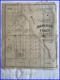
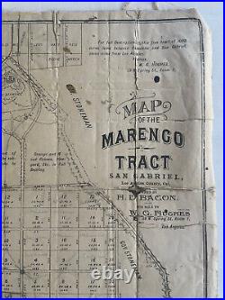
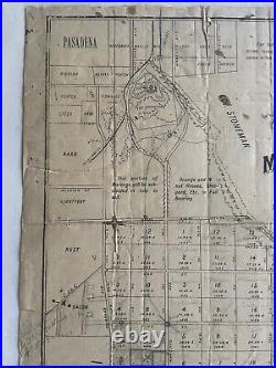
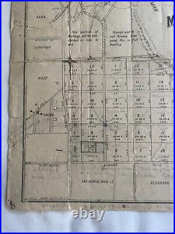
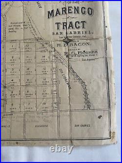
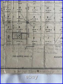

A rare piece of Southern California history. Map of the Marengo Tract San Gabriel, Los Angeles County, Cal. Bacon : For Sale By W. Room 1l Los Angeles. 1 map : uncolored ; 11 x 9 in. Scarce promotional broadside map, promoting the sale of Land in San Gabriel, California, The map shows Pasadena to the north, Alhambra, San Gabriel to the south. The map covers what was once Rancho San Pasqual, which has not been subdivided and is here shown as a tract map for sales promotion. The map identiies parcel owners, the Raymond Hotel, and Governor Stoneman’s property. The lands of the San Gabriel Wine Company are shown, as is Mission Street, Alhambra Road, Fair Oaks Avenue, Wilson Avenue, Marengo Avenue, Los Robles Avenue, Monterey Road, Oak Street, and Fine Street. As noted in Hiram Reid’s History of Pasadena: Marengo Tract. Called also “the Bacon ranch, ” 800 acres, comprised what is now the Raymond Hotel grounds, the Raymond Improvement Company’s lands, and the oak timber lands south of Monterey road and east of lower Fair Oaks Avenue. Its chain of title is a long story, it being parts of Ranchos San Pasqual and San Pasqualita. It was bought in 1855 by J. Brent, afterward a General in the Confederate army-‘- and who was still living at Baltimore, Md. Brent was a warm admirer of Napoleon Bonaparte, and named the ranch from Napoleon’s great battlefield of Marengo. Wilson, October 31, 1870. Wilson The present map shows the land in 20 acre parcels. By 1887, the Raymond Improvement Company was advertising the the sale of individual lots for the land immediatley north of the 20 acre parcels, which are noted on the map as a future subdivision: NOW READY FOR SALE. Raymond Improvement Company Tract II SOUTH OF AND ADJOINING THE GROUNDS OF RAYMOND HOTEL, SOUTH PASADENA, AND FORMERLY KNOWN AS THE UPPER MARENGO TRACT. Each lot to have connection laid to main pipes and to have FREE one share of stock in the MARENGO WATER COMPANY, thus insuring an abundant supply of pure water for irrigation aud domestic use. Easy and frequent communication now had with Los Angeles by the L. R,, with station at northwest corner of tract. The new line of the Southern Pacific Co. From the new town of Ramona northward, Is to run through the middle of tho tract, and first-class station Is to be established at the reservoir In front of the Raymond Hotel. GARFIELD AVENUE, running from Alhambra Station on the S. To Raymond Station on the L. It is 70 feet wide through the east side of this tract and will soon have a line of street cars in operation its entire length. Map shows San Gabriel, Los Angeles, California, Western US. Shows Pasadena to the north, Alhambra, San Gabriel to the south. Rancho San Pasqual: tract map for sales promotion; featuring parcel owners, Raymond hotel, Gov. Bacon; for sale by W. Raymond Hotel Pasadena, Calif. California, Southern — History — 19th century. Ranches — California — Pasadena. Real property — California — Pasadena. Los Angeles County Calif. Surveying — California, Southern — History. Copies in the Huntington and Stanford collections.

